


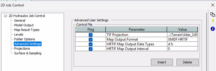
With TUFLOW 2023 releases, we can leverage the High-Resolution output in TIF format. XPSWMM 2024.2 and 2026 [Autodesk’s rebranded of 2024.2 release that doesn’t get us the latest engine] can use the Advanced Settings in the 2D Job Control to set this up.
Problem:
How do I establish a TIF Projection since XPSWMM projections are based on MapInfo MIF?
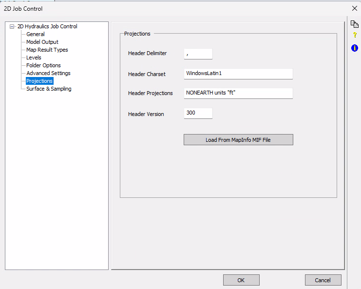
I would hope you have a TIF image referenced in the Surfaces & Sampling tab of the 2D Job Control that has this coordinate system built in.
Results:
The HRTIF results will now incorporate the Terrain’s lidar TIF image projection!
The difficulty here is that the user has 4 existing and 4 proposed models to choose from to make the change. Migrating to TUFLOW would make this one “model.”
If you have XPSWMM and no longer wish to spend $$$$, reach out to find out how TUFLOW can help!
What do you mean "Autodesk’s rebranded..."? I thought for sure Autodesk put hard work into each and every increment of the year in the product names!