


TUFLOW Acceptable TIFs
ERROR 0635 - TUFLOW does not currently support TIF tile format.

Thanks for the help!
PROBLEM:
Your TUFLOW or XPSWMM Output log shows that the run stop with Error 0635.

SOLUTION:
I will admit that I don’t use ESRI tools sufficiently enough so helping the younger engineers and GIS Professionals out with this is difficult. ESRI ArcGIS Pro will, by default, I guess generate a tiled TIFF when exporting a terrain surface.
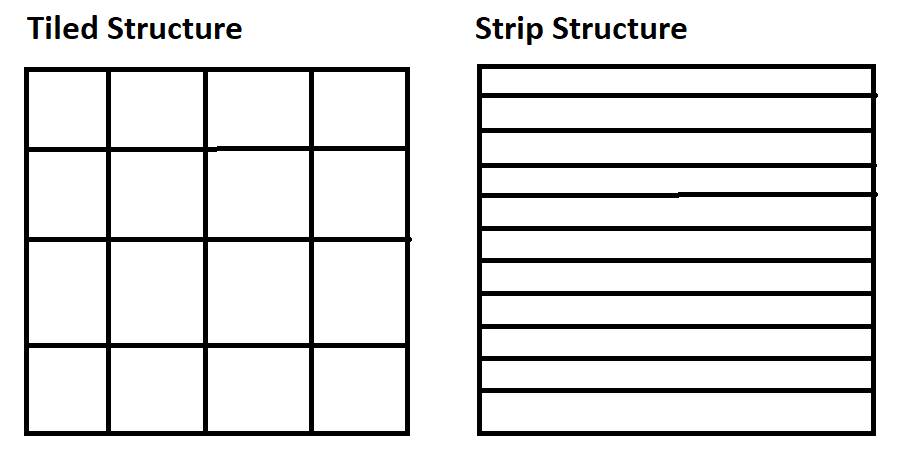
According to TIFF specifications,
For low-resolution to medium-resolution images, the standard TIFF method of breaking the image into strips is adequate. However high-resolution images can be accessed more efficiently — and compression tends to work better — if the image is broken into roughly square tiles instead of horizontally-wide but vertically narrow strips.
Workaround:
GDAL conversion will by default save said ESRI tiled image into a striped TIF. QGIS, which leverages GDAL, does the same.
SOLUTION 2:
The solution in ArcGIS Pro can be found in Project tab > Options > Raster and Imagery. (ArcGIS Pro 3.4 reference text)
Look for the Create tiled TIFF.


Sometimes the best answer is, I dont know, let me ask someone who might know. Thanks Michael.